One of the most common questions about Devil’s Lake is whether the glaciers made it. The answer is: partly — but the full story starts 1.7 billion years ago and passes through tropical seas, desert landscapes, and a catastrophic flood before arriving at the lake you see today. The timeline below traces that story from the oldest rocks in the region to the present, with notes on where you can see the evidence yourself.
~2.4 billion years ago
Oxygen first appears in Earth’s atmosphere. No complex life yet. The rocks that will become the Baraboo Hills are still hundreds of millions of years from forming.
~1.7 billion years ago — Baraboo Hills form
Ancient mountains are compressed and folded into the quartzite we see today. These rocks are older than the Rocky Mountains, older than the Himalayas — among the most ancient exposed rock in North America.
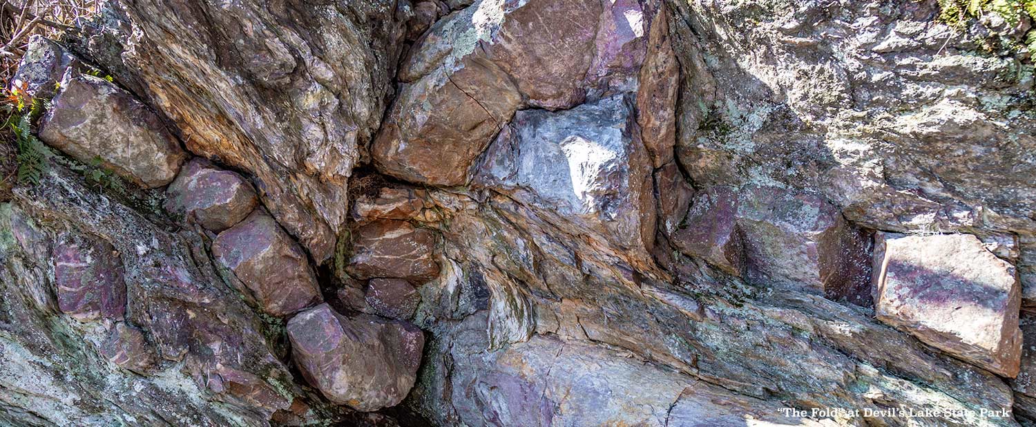
~1.65 billion years ago — the Baraboo Syncline folds
Tectonic pressure from the south compresses the region, folding the quartzite layers into a syncline — a bowl-shaped bend in the rock. Instead of breaking, the stone bends. That bowl-shaped fold is why the gorge exists where it does, the lake sits at its axis. A small exposed fold near the park’s north shore entrance preserves that moment of immense pressure in a section of rock you can stand beside and touch.
Deep time — shallow inland sea
The hills are submerged beneath a warm, shallow sea. Water currents ripple the sandy bottom. Those ripples are preserved in stone to this day — the only evidence of ancient environments you will find at Devil’s Lake.

Deep time — arid period
The sea retreats. Parts of central Wisconsin are shaped by wind and blowing sand — more like a desert than the lush landscape we know today.
The Great Unconformity — 1.2 billion years, missing
Between the ancient quartzite and the Cambrian sandstone that sits against it, there is a boundary line representing approximately 1.2 billion years of Earth history with no rock record here. The mountains eroded, seas came and went, continents shifted — and none of it left a trace at this location. To put it another way: if each year of that missing time were compressed to one second, the gap would represent nearly 40 years of vanished story.
~500 million years ago — tropical sea
The Baraboo Hills become a chain of islands rising from a warm tropical sea. The gorge where Devil’s Lake sits today is a narrow, storm-battered channel between those islands. Powerful waves leave percussion marks on the quartzite shores you can still find today.

~245–66 million years ago
The age of dinosaurs. These rocks were already ancient by the time the first dinosaurs walked the Earth — which is exactly why you will not find dinosaur fossils here. The Baraboo quartzite was a billion years old before T. rex existed.
~250 million years ago — sea retreats
The seas recede for the last time. Rivers strip away overlying sediments and re-expose the quartzite bluffs. An ancient river establishes itself through the gorge, flowing south and bending east at what is now the south shore of the lake.
~18,000–15,000 years ago — glaciers stall
The Wisconsin Glacier advances from the east and wraps around the Baraboo Hills rather than overriding them. As the ice stalls and melts, it deposits ridges of debris — terminal moraines — at both the north and south ends of the gorge, blocking the river. Devil’s Lake begins to fill.

Glacial retreat — Wisconsin Dells carved
As the glacier retreats, an ice dam east of Baraboo near the Narrows holds back a massive glacial lake. When the dam fails, the flood drains south in a catastrophic rush — cutting the deep sandstone gorges of the Wisconsin Dells. Devil’s Lake is already sealed behind its moraines; the flood passes around the east end of the hills entirely.
At the glacial margin — freeze, thaw, and time
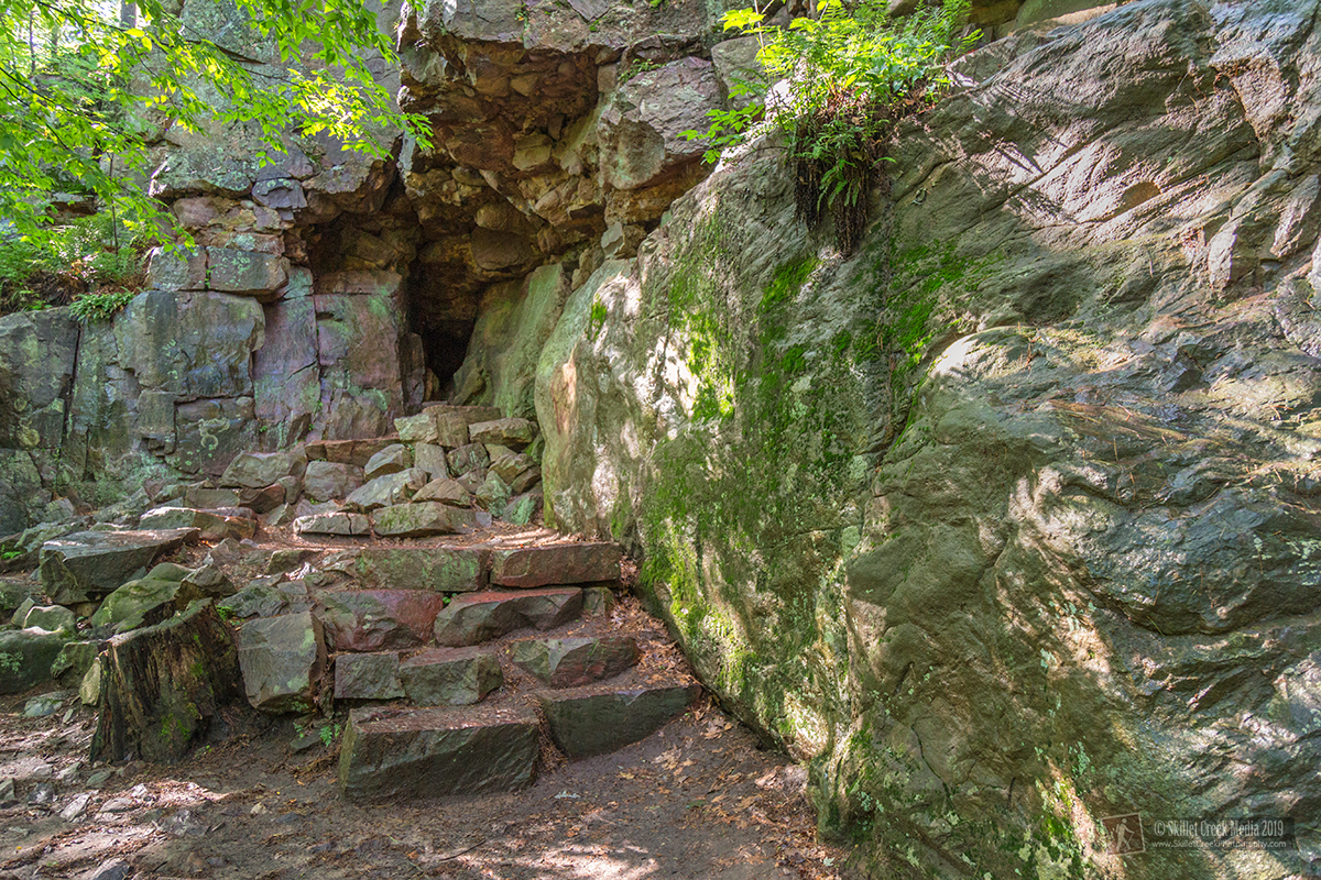
The quartzite bluffs stood exposed at the glacial margin — close enough to the ice that freeze-thaw cycling was intense and continuous. Over thousands of years this produces the boulder fields called talus on both bluffs. What remains standing becomes Devil’s Doorway, Balanced Rock, and the other named formations. Ancient potholes ground by pre-glacial rivers sit near the bluff top.

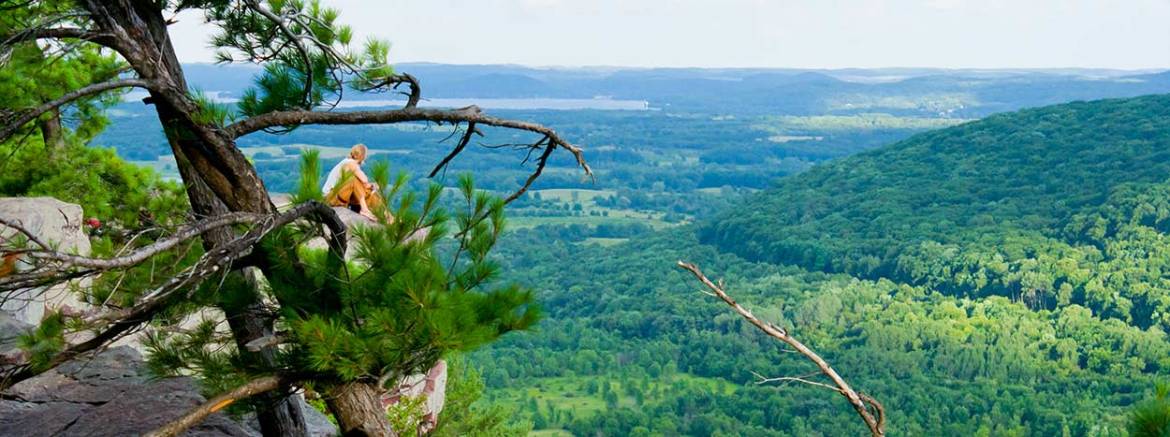
Today — Devil’s Lake
The lake occupies the same ancient gorge that was once a channel between tropical islands, then a river valley, then a glacial basin. It is fed by rainfall, groundwater springs, and a small stream entering from the southwest. The ancient meltwater that first filled it is long gone — recycled through Earth’s systems thousands of times over. What you are standing beside is 1.7 billion years in the making.
So did glaciers make Devil’s Lake? They sealed it. The ice blocked the gorge, trapped the water, and left behind the lake you see today. However, the gorge itself and the ancient quartzite that frames it were already 1.7 billion years in the making before the first glacier arrived. The Baraboo Hills are among the oldest exposed rock in North America, formed long before complex life existed on Earth — older than the Rockies, older than the Himalayas, older than nearly everything you can stand beside and touch anywhere on the continent. The glaciers didn’t make Devil’s Lake. But the bluffs, the boulder fields, the rock formations, and the lake itself would look nothing like they do today without them.
For visitors who want to go deeper, the park’s Nature Center offers geology exhibits and seasonal programs. The Discover section of this site covers related topics, including the park’s wildlife, human history, and the Ice Age landscape of the broader Baraboo Hills region.
** Credit goes to Charles R. Van Hise, Paul Herr, Ken Lange, Sue Johansen-Mayoleth, Keith Montgomery, Alton Dooley, and a host of other researchers, writers, bloggers, naturalists, and geologists whose concepts I’ve generalized and mangled to create this very short overview of Devil’s Lake State Park geology…
Read On!
- Wisconsin Glaciation – Wikipedia
- The Baraboo Ranges & Devil’s Lake Gorge
- Roadside Geology of Wisconsin – Robert H. Dott, Jr. and John W. Attig
- The Changing Earth – James Monroe, Reed Wicander