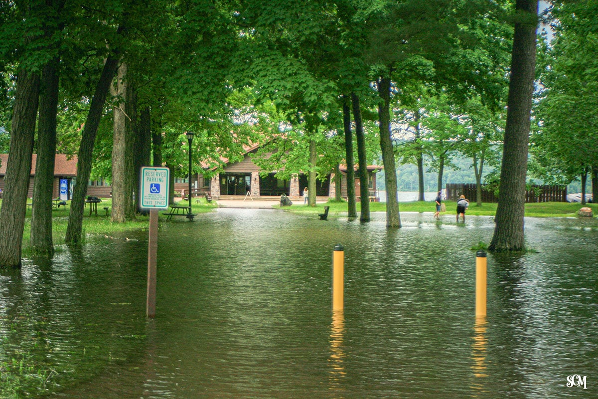
The North Shore boat launch and parking lot at Devil's Lake State Park closed Monday,…
Understanding the USGS Monitor and Why Water Management Matters
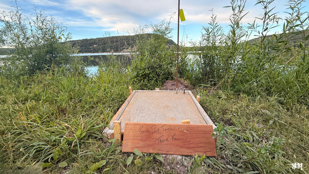
If you’ve walked the south shore on Cottage Road, you may have noticed a small concrete square with a “please don’t touch” sign. That’s a foundation for a new USGS water monitor location—a piece of critical infrastructure that tracks one of Wisconsin’s most important natural resources. Understanding how and why the park monitors water levels reveals a fascinating adaptation story about managing a complex lake system.
What Is the USGS Water Monitor?
The water monitor is a simple but essential tool: a gauge that measures the current water level of Devil’s Lake in real time. The USGS (United States Geological Survey) maintains the station, and the data is publicly available to anyone who wants to check it. While the technical details of extracting that information can be challenging, the good news is that you don’t need to hunt for raw data. Our Current Conditions page displays the live feed with low, normal, and high water ranges clearly marked, so you can see at a glance whether the lake is running high or low.
For most of us, what matters is practical: high water means less beach. Low water can impact fishing and also make launching your boat difficult.
Why Devil’s Lake Needs Active Water Management
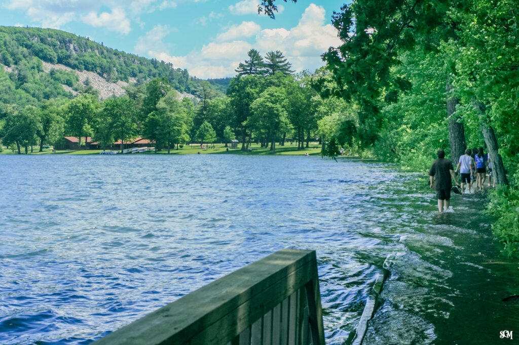
Devil’s Lake is a closed system. Water doesn’t leave the lake except through evaporation or seepage into the ground layers. This means the lake’s water level depends entirely on the balance between water coming in (springs, rainfall, snowmelt, groundwater) and water leaving (evaporation and seepage). With no natural outlet, the lake can rise dangerously during wet years and heavy precipitation events. Until fairly recently, flooding was becoming increasingly common as Wisconsin’s climate patterns shifted toward more intense rainfall events.
The 2002 Water Quality Solution That Became a Flood Management Tool
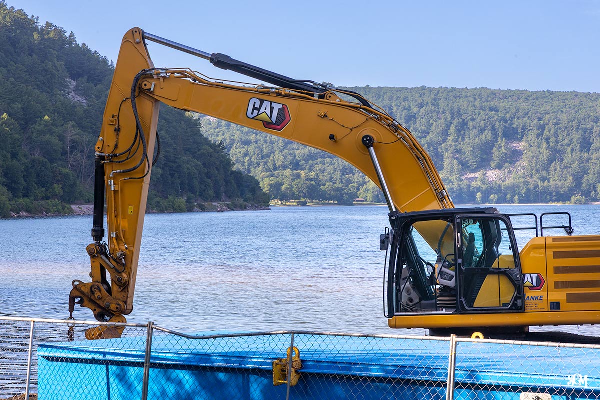
In 2002, the Wisconsin DNR installed a drainage system designed to remove phosphorus-rich water from the lake’s deepest layer. The goal was to improve water quality and reduce algae blooms. But the DNR soon realized this system could serve a dual purpose: it could also manage water levels during high-water periods by providing an outlet when the lake threatened to overflow.
However, the original design had an issue when it came to flood management. The system could only operate after mid-April, when the park turned on its seasonal water systems. This meant that during winter snowmelt and spring rains—precisely when water levels rose most dramatically—the drainage system sat idle.
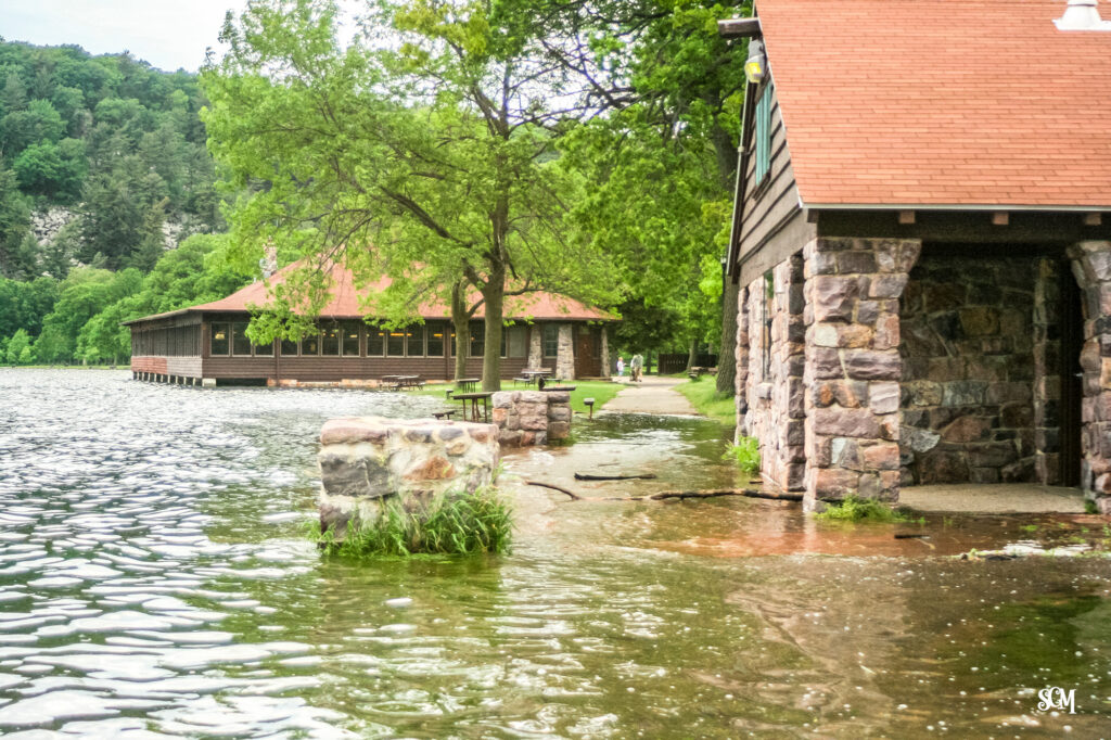
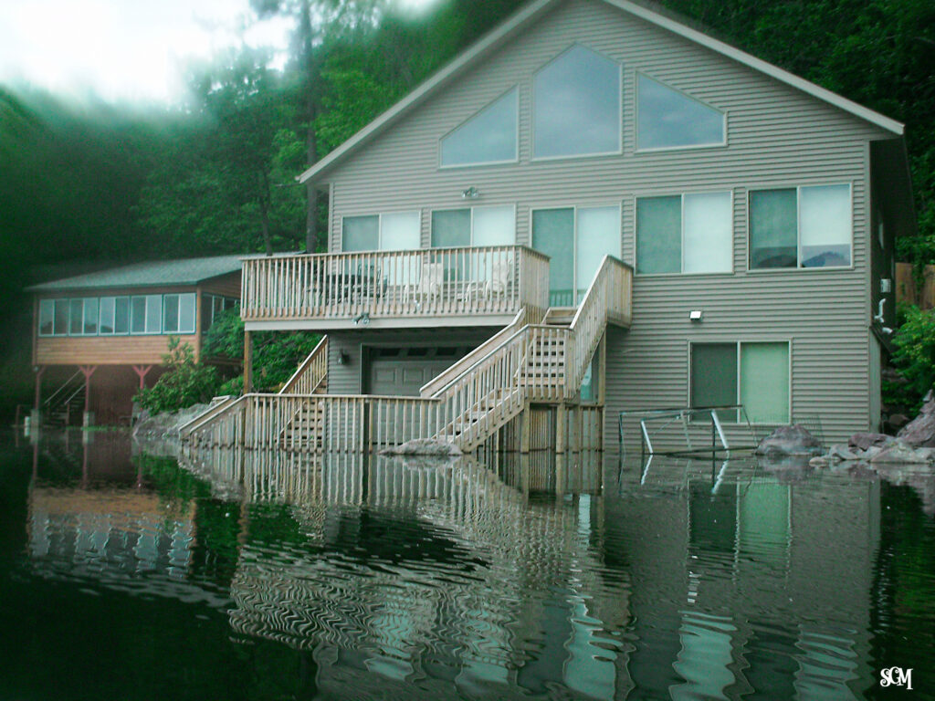
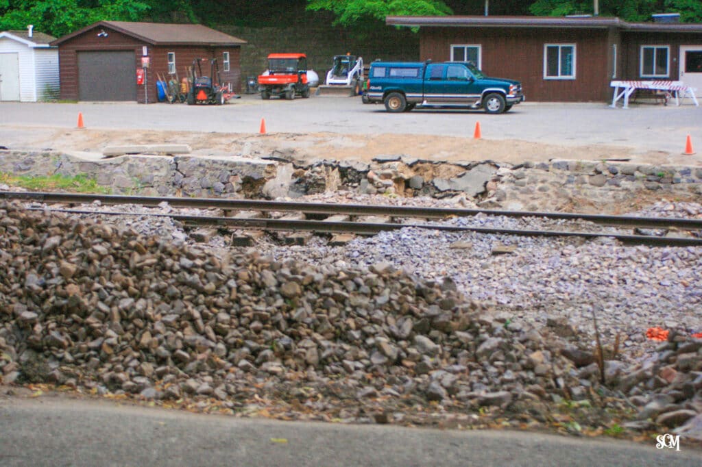
In 2008, this had serious consequences. Heavy snowfall accumulated throughout the winter. Spring rains followed. By the time the drainage system activated in mid-April, the lake was already dangerously high. In early June, additional storms pushed the lake two feet above flood stage. Water overtopped the shoreline, causing major damage around the park.
The 2009 Redesign: A Year-Round Gravity-Fed System
The DNR responded quickly. In November 2009, less than a year and a half after the 2008 disaster, they redesigned the system to operate year-round. The new design uses gravity feed rather than a seasonal on-off switch, meaning water can drain continuously whenever the lake level rises above a certain threshold—regardless of whether the park’s seasonal water systems are running.
The effectiveness of the redesigned system was tested and proven during the major flooding events of 2018 and 2019. When Madison-area lakes like Fish Lake and Crystal Lake suffered significant damage from extreme precipitation, Devil’s Lake remained within normal bounds. The gravity-fed drainage system had worked exactly as intended.
How to Check Devil’s Lake Water Levels
You have two options for monitoring the current water level:
Option 1: Access the raw USGS data directly through the USGS website. You’ll need the monitor station number, and the process can be technical if you’re unfamiliar with government databases.
Option 2: Visit our Current Conditions page, where we display the live feed in a user-friendly format. You’ll see the current level, the normal range, and whether the lake is running above or below average—all with practical context for what that means for your visit.
The Larger Context
For a deeper understanding of how this drainage system works and why it was originally installed, read “A Drain in the Lake?” in our Learning Center. For broader context on flooding challenges across southern Wisconsin and how different lakes have been affected by changing precipitation patterns, see “Flooding in Southern Wisconsin Lakes” by Dea Larsen Converse, WICCI Science Writer.
Sources: Wisconsin DNR Press Office; “Flooding in Southern Wisconsin Lakes,” Dea Larsen Converse, WICCI Science Writer; interview with Richard Lathrop, retired research limnologist, Wisconsin DNR.

For nearly 30 years, the Skillet Creek blog has focused on 3 main goals; To inspire you to visit and explore the Devil’s Lake region, to help you get the most out of your visit by sharing tips, events, and other helpful information. Lastly, to advocate for our environment & wildlife and talk about how we can keep our natural areas amazing now and into the future! That last goal can sometimes cause controversy, but it’s the only way we can accomplish the first two. – Derrick Mayoleth, Owner.
Related Posts