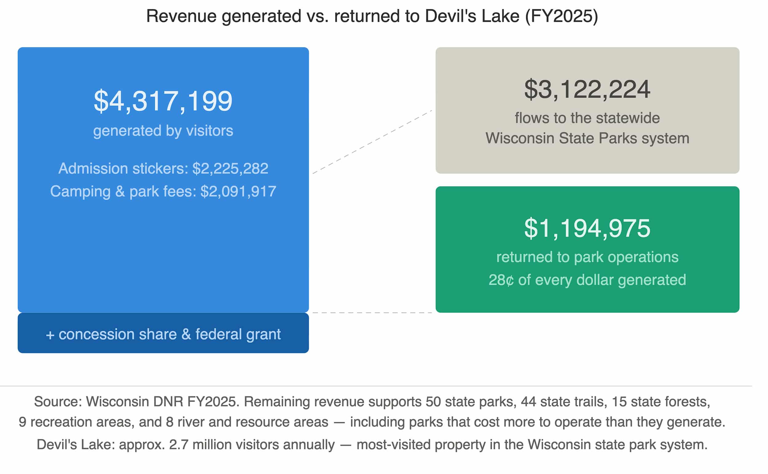
Devil's Lake State Park draws approximately 2.7 million visitors a year: more than any other…

As you know, a couple of weeks back we had elevated levels of E. Coli on Devil’s Lake State Park’s North Shore Beach. Just a few days later, the water tested fine and the advisory was dropped. The big question now is, how do you find out what the lake’s current status is before you come?
Well, that’s fairly easy. The Wisconsin DNR maintains a beach closing and advisory map as well as a Beach Report Database. We have links to both through our Current Conditions & Swimming Information pages here on DevilsLakeWisconsin.com as well.
DNR Beach Closings & Advisories Map
DNR Beach Monitoring

For nearly 30 years, the Skillet Creek blog has focused on 3 main goals; To inspire you to visit and explore the Devil’s Lake region, to help you get the most out of your visit by sharing tips, events, and other helpful information. Lastly, to advocate for our environment & wildlife and talk about how we can keep our natural areas amazing now and into the future! That last goal can sometimes cause controversy, but it’s the only way we can accomplish the first two. – Derrick Mayoleth, Owner.
Related Posts