As we start talking about changing leaves, it's good to note that fall colors are…
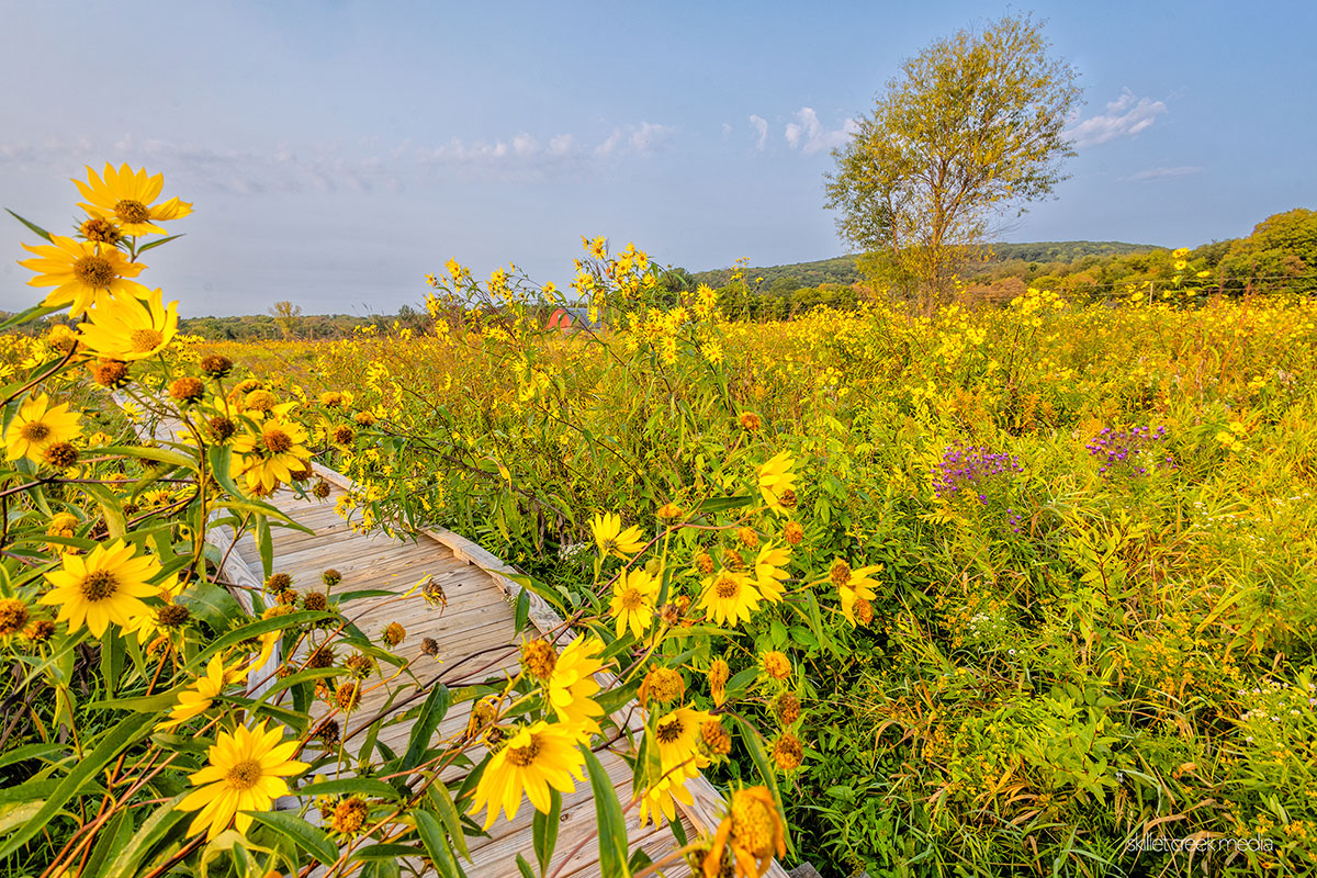
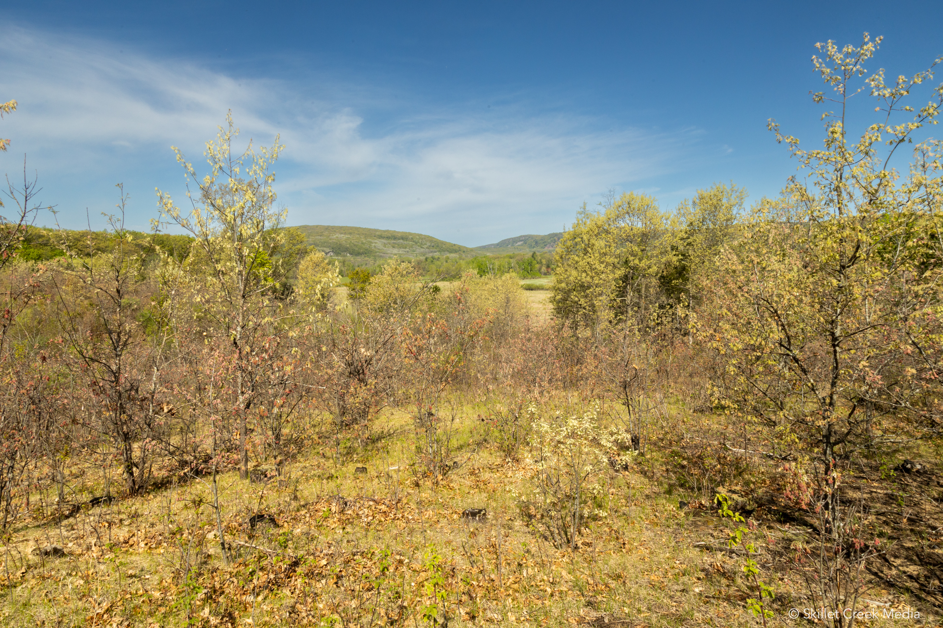
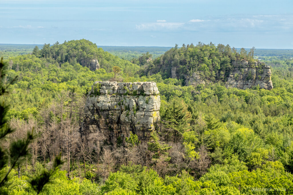
Mill Bluff State Park, just an hour north of Devil’s Lake State Park, would probably have a lot more visitors if it had a catchier name. The park is known for its sandstone hills and mesas rising from an otherwise flat landscape. But rather than thinking of these outcrops as bluffs, we should think of them as islands. In fact, standing on top of the overlook on the crest of Mill Bluff, it’s easy to visualize the distant outcrops as the islands and sea stacks they were in the past.
Back then, during the last stages of the Wisconsin Glaciation, north-central Wisconsin was covered by a shallow glacial sea. It was held in place by an ice dam located near present-day Wisconsin Dells*. The 60-80 ft deep, turbulent, and icy waters that surrounded these islands was dotted with roaming icebergs that would crash into their rocky walls and drop embedded rock at their feet that had come all the way from Canada. These rocks are called “erratics,” and are identifiable because they are not part of the local geological landscape.
The Wisconsin Glaciation was the most recent major advance of the North American ice sheet complex. It began approximately 75,000 years ago and reached its maximum extent around 25,000 years ago. During this time, much of North America, including Wisconsin, was covered by a thick layer of ice. As the climate warmed and the ice began to melt, it left behind a dramatically altered landscape, including the formation of numerous glacial lakes and the deposition of glacial sediments.
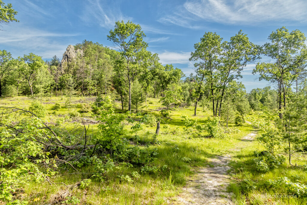
Most visitors to Mill Bluff State Park probably miss the real experience of these islands forged by sea and wind, as climbing Mill Bluff should just be an introduction, not your main goal. Once atop the bluff, visitors can identify these islands, from Bee Bluff in the foreground to Wildcat Bluff in the distance. They should then do their best to travel to them. From the park entrance on Funnel Road, visitors can continue on Funnel Road, cross the Interstate, and hike the Camel Bluff trail. This beautiful little loop will take them along the former lake bed at the base of Camels Bluff, Devil’s Monument, and their very own Cleopatra’s Needle. Continuing on Funnel Rd., beyond the Camels Bluff parking area, you can get a much better view of Bear Bluff and Wildcat Bluff as well. But even then, you will not have seen the real star of the park.
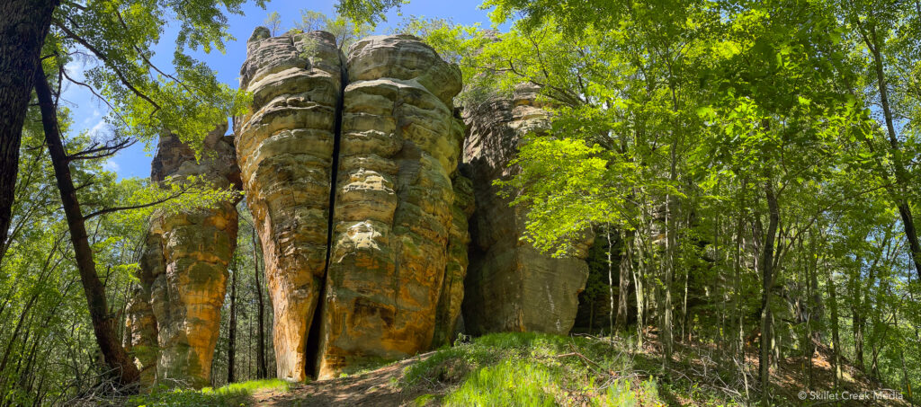
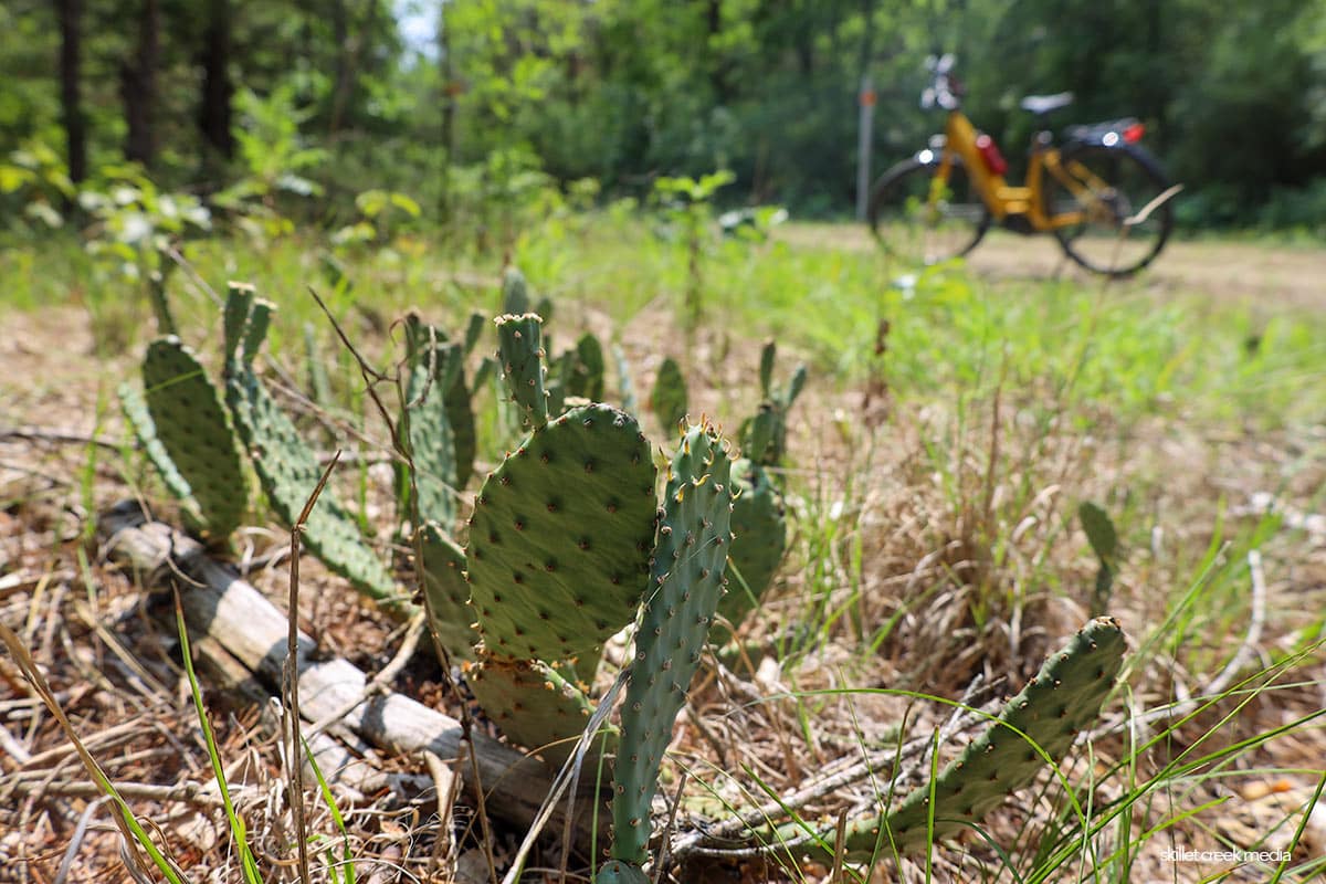
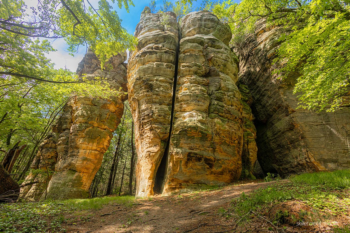
The most amazing sight among these islands of time is the collection of sandstone pinnacles and arches tucked away in the far north-east corner of the park at a place called Ragged Rock. If you have never seen them before, this compact collection of tall sandstone pinnacles and arches on the southern edge of Ragged Rock will blow you away. It is as if South Dakota’s rocky pinnacles had been modeled in sandstone and just dropped into the forest. Amazing!
Many of the area bluffs also contain 6-12 inches-long petroglyphs (rock carvings) shaped like bird tracks. Similar to the petroglyphs found 25 miles east in Roche-A-Cri State Park, they date back to the Upper Mississippi Indian culture about 400 years ago. (Roche-A-Cri was another island in that long gone glacial sea.)
After taking a closer look at Mill Bluff State Park, I’m convinced that if the park had been given a slightly snappier name and a bit more focus and love, it would probably be one of the more heavily visited parks in the state, even if most visitors would only need to explore for a couple of hours.
If you plan to visit Mill Bluff State Park, please remember that these unique glacial features are protected as one of nine units of the Ice Age National Scientific Reserve. Because of the uniqueness of this park and the delicate nature of the sandstone structures, climbing on or defacing the bluffs is strictly prohibited.
* While the official DNR website locates the ice dam at Wisconsin Dells, another perspective is that the ice dam was situated near Cascade Mountain east of Baraboo. I’ll have to read up!
To Learn More Visit The Official Mill Bluff State Park Website.

For nearly 2 decades the Skillet Creek blog has focused on 3 main goals; To inspire you to visit and explore the Devil’s Lake region, to help you get the most your visit by sharing tips, events, and other helpful information. Lastly to advocate for our environment & wildlife and talk about how we can keep our natural areas amazing now and into the future! That last goal can sometimes cause controversy, but it’s the only way we can accomplish the first two. – Derrick Mayoleth, Owner.
Related Posts